Knowing the exact area and structure of your fields is the basis for effective land bank management, a guarantee of proper use of the budget, and the first step towards implementing precision agriculture.
Reliable data on the area of cultivated fields are needed not only for high-quality cadastral accounting but also allow to determine the exact amount of costs for field cultivation - seed, fertilizers, plant protection products, fuel and oil materials, etc.
The cadastral data are not always accurate and do not take into account the presence of problem areas within the field that are not cultivated (e.g. swamps, ravines, ditches, etc.). Also, the actual size of fields may change over time: due to the appearance or disappearance of roads, the growth of forests, the formation of uneven terrain, etc.
According to the experience of Culver Aviation, to correctly calculate the number of costs and unnecessary expenses at the planning stage of agricultural work, the measurement of fields should be carried out every year or two, depending on the size of the farm and the dynamics of changes in the land bank.
Also, every year before the start of the season, it is essential to monitor even minor changes in the contours of the fields and the location of objects on the field: for example, when replacing power line poles, swamping, forest growth, etc. All of them in one way or another affect the productive area of the field, and their exact coordinates are necessary to build optimal routes for the movement of equipment.
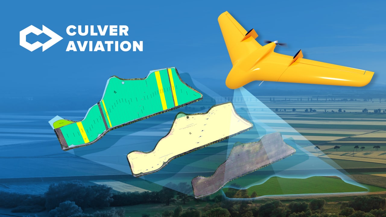
Field area measurement using UAVs
Using UAVs to measure fields is one of the most accurate ways to determine the real contours and areas of cultivated areas. Equipped with high-precision navigation systems and high-resolution cameras, they allow you to obtain data to identify the difference between the leased areas and the cultivated areas with centimeter accuracy. Also, with the help of images obtained from the drone, orthophoto maps are created, which will help to investigate the situation inside the field, inaccessible during the usual inspection, the condition of the plots, and the location of objects.
For aerial photography and field measurement, the Culver Aviation team uses a serial UAV of its design "Skif". All of our drones are equipped with high-precision 61 MP cameras and GNSS receivers, which allow us to obtain images with a resolution of up to 1 cm per pixel. During one flight, "Scythian" manages to cover an area of 1000 hectares, and our production of drones allows us to scale unlimitedly and conduct research even in large areas.
It was with the help of the Scythian drone that Culver Aviation conducted a survey of sown areas on one of the sites of an agricultural enterprise in the Ivano-Frankivsk region. We will tell you how the analysis of the information obtained will help the customer avoid unnecessary losses and properly plan their budget.
How inaccurate land bank data affects business losses: Culver Aviation case
The Culver Aviation team was faced with the task of comparing cadastral data of land plots with their actual area. For this purpose, the contour of the field was measured with the help of UAV "Skif" and its actual area was determined, as well as by creating an orthophoto map and marking the problem areas - the area that is cultivated.
Thus, according to the results of the study, it was found that the farm cultivates only 21.08 hectares of the total area of 22.30 hectares. Thus, the difference was 1.22 hectares, which is almost 5.5% of the total area. If we recalculate the average yield of the sown crop, then only because of inaccurate data on its land bank, the company did not receive almost 100 centners of corn from only one plot. And this is only because of the difference between the leased areas and the cultivated ones.

Having analyzed the problem areas on the field from the air, namely soaking, trampling, sowing, and so on, it was determined that their total area is 0.81 hectares, which is almost 4%. In terms of crop losses, we have another 65 centners of shortage.
Thus, due to irrelevant data on its land bank and the situation in the field, the company lost 16.5 tons of crops. Given this year's average cost of corn per ton is 8500 UAH, it is easy to calculate the monetary equivalent - more than 140 thousand hryvnias. And this is without taking into account the costs of improper planning of fieldwork and the number of resources used during their implementation.
Also, within the framework of the project, our specialists prepared a relief map of the site, which will allow the customer to plan the workflow and distribution of production resources more expediently in the future.
The project implemented by the Culver Aviation team clearly shows how inaccurate data on the actual cultivation area affects business losses. If these figures were significant enough for a 20-hectare plot, imagine how significant they can be for a 10,000-hectare farm.
Culver Aviation specialists are always ready to help you with field measurement and the creation of georeferenced orthophoto maps with numbered sections and contours. Optionally, a digital map of the field can be created taking into account the features of the relief, and the drone is equipped with a multi-spectral camera for a more detailed study of the condition of crops.
How Culver Aviation measures the fields:
- we receive from the customer cartographic data (if available), cadastral numbers of target areas or schemes of arrays (fields);
- Culver Aviation specialists analyze the materials provided by the customer, draw up a flight task;
- the service team goes to the site to conduct aerial photography;
- GIS specialists process the survey data;
- the client receives a high-precision orthophoto map of the field, its contours, and area, as well as optionally other necessary data and analytics in a specific format.
Do you want to determine the area and exact contours of your plots before the start of the new season to avoid unnecessary losses and properly plan your budget? Please call 0 800 351 709.